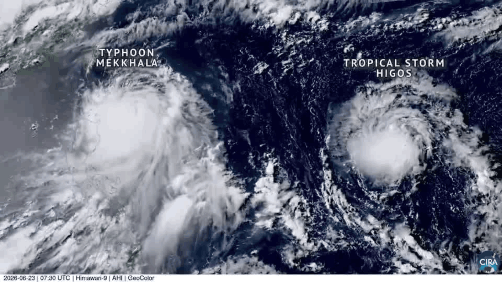


Philippines: Satellite imagery captured Typhoon Mekkhala churning over the Philippine Sea across Monday to Tuesday as the powerful storm tracked west-northwestward east of the Philippines, with a second tropical storm, Higos, visible in the same field of view.
Typhoon Mekkhala, known locally as Francisco, rapidly intensified over the Philippine Sea on Monday, strengthening into a super typhoon in the evening with maximum sustained winds of 185 kilometers per hour and gusts of up to 230 kph, according to the Philippines' national meteorological agency. The weather bureau said it was not ruling out the possibility of Francisco reaching an even higher intensity.
Meteorologists said Mekkhala was located east of Luzon Island in the Philippines and had begun turning northward, with the storm expected to move along waters east of the Philippines before tracking toward Okinawa and southern Japan. Philippine authorities warned of possible flooding, landslides and rough seas in the country's two northernmost provinces as the powerful typhoon roared offshore.
Tropical Storm Higos, visible in the satellite imagery near Mekkhala, was not expected to strengthen significantly and was forecast to remain without a storm-force wind zone, according to the Japan Meteorological Agency.